Home » Success Stories »
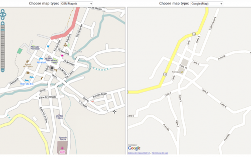
The project aims to disseminate the OpenStreetMap (OSM) collaborative tool as a means to make visible the rural communities in Bolivia that are currently not shown on maps and, therefore, are not taken into account when making decisions that affect their territory.
The project has been led by the Universidad Politécnica de Madrid and coordinated by Claudia Uberhuaga (from Cochabamba, Bolivia). UPC’s role has been to support the Mapping Bolivia project by contributing its knowledge and expertise in OSM.
In order to carry out the project, a pilot test was carried out in which 20 members of the indigenous community of the Totora area were trained in the use of GPS, each of them moved around their community registering roads and other points of interest. For example, health centers and churches. In some cases, they had to walk for more than two days to reach their community. The result was excellent and at a practical level most of the communities around Totora were mapped.